


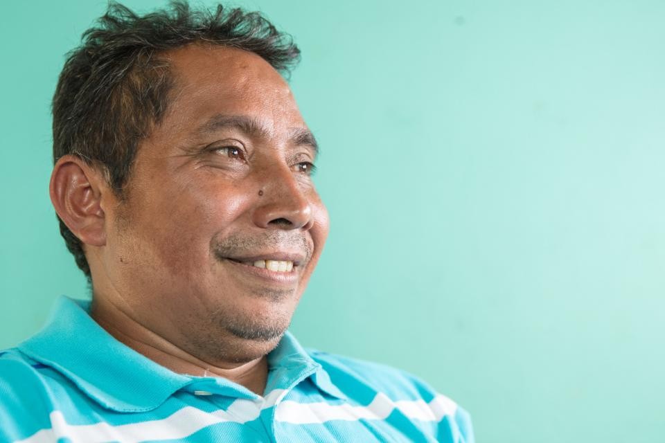
Affordable housing benefits children in Honduras | Hear from Jos? and Martha
26 July, 2017
Habitat Magazine december 2017
22 November, 2017Reducing Risk to Disasters by Securing Land Tenure: A Case Study in Portmore, Jamaica

Mapping and verification assistant Akeem, who was promoted to Junior Land Surveying Technician, sharing his map with community members for their feedback and corrections.
By: Javier Cidón, Disaster Risk Reduction Caribbean Manager, Habitat for Humanity International, and Salina Solomon, Land Tenure Specialist, Habitat for Humanity Jamaica
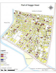
Part of Naggo Head.
Since 2015, Habitat for Humanity has been implementing a Disaster Risk Reduction (DRR) pilot project called BRACED (Building Resilience and Capacities for Emerging Disasters) in the municipality of Portmore, Jamaica. The project focuses on increasing the resilience of housing, improving access to water, hygiene, sanitation and waste management, building public-private partnerships, upgrading human settlements through redevelopment plans and identifying critical infrastructure interventions.
The whole project is based on an innovative and inclusive neighborhood-based approach, which focuses on participatory methodologies aimed to build the capacity of the target communities through training, empowerment of community groups and advocacy activities. This approach is based on the idea that the people of a community are the core of it, and, if the people are empowered, then the community will become more resilient.

GIS Analyst and Land Technical Specialist working in the community with mapping and verification assistants to record in the GIS database information (sketches of houses and plots, building materials, owner and tenant names) gathered in the field.
Another innovative and successful feature of this project is the focus on improving land tenure security to increase household and community resilience to disasters. Communities plagued by insecure land tenure tend to have poor housing stock, poor physical infrastructure, high crime rates and relatively high levels of illiteracy. This demotivates the community from making improvements, which increases their vulnerability over time. The conventional approach of focusing on physical infrastructure improvements and using outside technical professionals and staff alienates the community, ignores the real issues and creates improvements that are short-lived because they are not integrated or sustainable.

Mapping and verification assistant Akeem, who was promoted to Junior Land Surveying Technician, sharing his map with community members for their feedback and corrections.
To address the underlying problem of insecure land tenure, it is critical to emphasize participatory methods and build the capacity of the community to ensure DRR practices continue even after the project is completed. In Portmore, Habitat for Humanity implemented the following strategies:
- Community members creating/vetting all publications in reinforcement of salient points based on local context.Identification and bridging of the gaps between the community and access to government programs that already exist to increase tenure security. The project has successfully made an application on behalf of the community to be declared a special area for tenure upgrades, which speeds up the time and reduces the cost. A precursor to upgrading freehold tenure is up to date payment of property tax. The project is also in the process of applying for a property tax amnesty to remove this roadblock.
- Reinforcing key concepts including why secure land tenure is important, how to secure land tenure and why secure land tenure builds resilience against disaster.
- Community participation and leadership in all aspects of the project including:

Community member showing the survey team his land papers which were passed down from his great grandfather.
Day-to-day operations: Community members were placed on staff in technical and administrative capacities.
Technical operations: All land surveying and tenure improvement teams were comprised 95% by community members.
Special activities: Community members planned and/or led community sensitization meetings, enumeration, and mapping exercises.
- Strong mobilization.
- Assignment of a community member to critical persons/departments to understudy them, thus preparing them for future advocacy.
- Targeting vulnerable groups, in this context mainly women, elderly and people with disabilities.
- Creation of guides, redevelopment plans and fast-track documents as references for community members and the project close-out hand over agency, in this case, the municipal council.

Junior land surveying technician and survey assistant, trained community members, assisting the licensed surveyor to set up GPS equipment.
At the household level, the project is showing that securing land tenure increases families’ interest in investing in their houses because they feel more confident about not being evicted from their plots, and because the land is a marketable asset that can provide access to credit. At the community level, the formalization of community land improves access to infrastructure investments, as the government is now able to provide public services denied to informal settlements, such as water piping, electricity and drainage. Within the project timeframe, a redevelopment plan will be also designed.
Before this ideal of stability and self-reliance could be achieved, the minds of the community members had to be transformed from thinking of their community as second rate and their conditions as marginal to envisioning their community as uplifted and their properties as valuable. During the first phase of the project, trained community members, called mapping and verification assistants, created maps of all the plots within the community, recorded the names of owners and tenants as well as drew the house(s) on each plot. The opportunity to undertake such a meaningful task and holding complex positions in the organization bolstered community support and excitement as the community had never been mapped before. The completed community map symbolized an acknowledgement of all the people who had lived in the community for so long but have gone unrecognized, which built esteem and made the community see the value in their settlement.
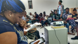
Naggo Head community enumerators in training.
The formalization of the land is being done through a transparent and inclusive approach, which enables the participatory process, empowers community structures and ensures that all community members can participate and access a more secure type of land tenure. This increases the likelihood that the most vulnerable households have equitable access to titles for their land (i.e. women will be able to register their plots). At each stage of the project’s land tenure initiatives – tenure research at the office and field level, mapping and verification, land surveying and the special declaration of the community – community meetings were held to discuss all aspects of the process. Community mobilization was crucial for the success of the project.
Community women pointing out their plots on the map.
Ultimately, the formalization process aims to identify a fast-track and low-cost procedure that could be replicated in other settlements in Jamaica. This is being done in partnership with different national and local government agencies which are showing a tremendous interest and fully supporting this experience.
This project is ongoing and is expected to end in December 2017. An evaluation of this land component will be held this month, and its results and lessons learned will be shared in this blog.

